
Fatigue kills, take a break.
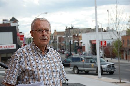
Kenora Mayor Len Compton has viewed those highway signs that greet motorists entering northwestern Ontario from Manitoba.
While you'll get no complaints from Compton about Ottawa and Queen's Park's expenditure of $100 million to twin a dangerous stretch of the Trans-Canada Highway next year, finding a place for motorists to relieve themselves in -20C degree weather would make it a tad better.
In May, Prime Minister Stephen Harper and Ontario Premier Dalton McGuinty announced the flow of cash to four-lane a 10-kilometre stretch of road between Kenora and Manitoba was finally on its way.
Starting with an environmental assessment, work gets underway in 2010.
A route planning and design study is also underway to expand an additional 30 kilometres of highway. The money is coming from the $6.2 billion Building Canada pot shared between Ottawa and Ontario that first announced last summer.
With the forestry struggling, the City of Kenora wants to build a new economy around a safer, wider highway that brings more cottagers, tourists and the semi-retired into this picturesque of 15,000 on Lake of the Woods.
This length of Highway 17 on the Trans-Canada Highway is Canada's main east-west transportation artery. It sees about 4,000 vehicles a day, which doubles in traffic during the summer. About a 20-kilometre stretch between the Ontario border and Falcon Lake in Manitoba is one of few parts of the Trans-Canada that is not a four-lane divided road.
Having rest stops in place for weary drivers is a big issue with Compton.
“We are having a lot of (highway) deaths because of fatigue,” said Compton who calls the rocky and mostly forested stretch between the Manitoba border and Vermilion Bay a “death corridor.” It's not uncommon for the road to be closed once every two weeks for up to eight hours because of car accidents.
The Canadian Automobile Association will attest to that in naming it one of the worst roads in Ontario in 2007.
For tired cross-Canada drivers traveling at night or motorists with incontinence problems, the only avenue to relieve themselves is behind the car.
Compton said building a rest stop on the Highway 17 bypass with a tourism kiosk at the Redditt Road intersection would be an the ideal place.
However there are government-imposed buffer zones allowing no development for 1,500 feet on either side on the road. The bypass itself only provides limited access to town.
Last summer, senior Ministry of Transportation bureaucrats commissioned a study to examine the location of rest stops in Northern Ontario, but it's expected to take a year and half, said Compton.
“Better too many, than none,” said Compton, who fired off a letter to Bruce McCuaig, Ontario's deputy transportation minister Bruce McCuaig to get things moving.
Compton said he was told a possible rest stop site being considered to serve the area is just west of Thunder Bay, more than a five-hour drive from Kenora.
“They (Ministry of Transportation bureaucrats) have different ideas where it should be and it doesn't really work.”
The City of Kenora is applying for $2.3 milliion in funding under the Building Canada fund to situate a year-round waterfront tourist information centre on Lakeview Drive between Kenora and Keewatin.
An Ontario tourist information centre is at the border, the so-called gateway to Ontario, but Compton said it's only open four months a year.


